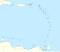
Dataja:Lesser Antilles location map.svg

Größe der PNG-Vorschau dieser SVG-Datei: 698 × 599 pikselow. Druhe rozeznaća: 280 × 240 pikselow | 559 × 480 pikselow | 894 × 768 pikselow | 1.192 × 1.024 pikselow | 2.385 × 2.048 pikselow | 1.346 × 1.156 pikselow.
Wersija z wyšim rozeznaćom (SVG-dataja, zakładna wulkosć: 1.346 × 1.156 pikselow, datajowa wulkosć: 184 kB)
Wersije dataje
Klikń na wěsty čas, zo by wersiju dataje w tutym času zwobraznił.
| Čas | Wobrazowy napohlad | Rozeznaće | Wužiwar | Komentar | |
|---|---|---|---|---|---|
| aktualnje | 24. septembra 2018, 15:59 |  | 1.346x1.156 (184 kB) | NordNordWest | Reverted to version as of 14:01, 13 October 2010 (UTC); please don't change the size of the map, some templates need the correct size |
| 24. septembra 2018, 14:00 |  | 512x439 (114 kB) | Splintax | Nations grouped together and labelled with DOM IDs and inline styles replaced with semantic CSS classes. This reduces the file size and allows the SVG to be animated with JavaScript (eg. to selectively add labels, or change the style of a particular country to highlight it). | |
| 13. oktobra 2010, 16:01 |  | 1.346x1.156 (184 kB) | NordNordWest | upd | |
| 29. septembra 2009, 17:56 |  | 1.346x1.156 (281 kB) | NordNordWest | =={{int:filedesc}}== {{Information |Description= {{de|Positionskarte der Kleinen Antillen}} Quadratische Plattkarte, N-S-Streckung 103 %. Geographische Begrenzung der Karte: * N: 19.2° N * S: 9.7° N * W: 70.5° W * O: 59.1° W {{ |
Datajowe wužiwanje
Dataja so na slědowacych stronach wužiwa:
Globalne wužiwanje dataje
Slědowace druhe wikije wužiwaja tutón wobraz:
- Wužiwanje na af.wikipedia.org
- Wužiwanje na als.wikipedia.org
- Wužiwanje na ar.wikipedia.org
- Wužiwanje na az.wikipedia.org
- Wužiwanje na ba.wikipedia.org
- Wužiwanje na be.wikipedia.org
- Wužiwanje na bs.wikipedia.org
- Wužiwanje na ceb.wikipedia.org
- Wužiwanje na ckb.wikipedia.org
- Wužiwanje na cs.wikipedia.org
- Wužiwanje na da.wikipedia.org
- Wužiwanje na de.wikipedia.org
- Liste der Nationalparks im Königreich der Niederlande
- Oranjestad (Sint Eustatius)
- Benutzer:Spischot/Sketchpad 3
- Cricket World Cup 2007
- Flamingo International Airport
- Kralendijk
- Vorlage:Positionskarte Aruba
- Wikipedia:Kartenwerkstatt/Positionskarten/Nordamerika
- Juancho E. Yrausquin Airport
- West Indies Cricket Team
- Vorlage:Positionskarte Niederländische Antillen (ABC-Inseln)
- Vorlage:Positionskarte Niederländische Antillen (Inseln über dem Winde)
- Vorlage:Positionskarte Kleine Antillen
- ICC World Twenty20 2010
- ICC Women’s World Twenty20 2010
- Vorlage:Positionskarte Curaçao
- Vorlage:Positionskarte Sint Maarten
Globalne wužiwanje tuteje dataje pokazać

