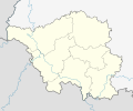
Dataja:Saarland location map 2.svg

Größe der PNG-Vorschau dieser SVG-Datei: 721 × 600 pikselow. Druhe rozeznaća: 289 × 240 pikselow | 577 × 480 pikselow | 923 × 768 pikselow | 1.231 × 1.024 pikselow | 2.461 × 2.048 pikselow | 1.060 × 882 pikselow.
Wersija z wyšim rozeznaćom (SVG-dataja, zakładna wulkosć: 1.060 × 882 pikselow, datajowa wulkosć: 244 kB)
Wersije dataje
Klikń na wěsty čas, zo by wersiju dataje w tutym času zwobraznił.
| Čas | Wobrazowy napohlad | Rozeznaće | Wužiwar | Komentar | |
|---|---|---|---|---|---|
| aktualnje | 14. meje 2013, 22:15 |  | 1.060x882 (244 kB) | NordNordWest | == {{int:filedesc}} == {{Information |Description= {{de|Positionskarte für das Saarland, Deutschland}} Geographische Begrenzung der Karte: * N: 49.7° N * S: 49.05° N * W: 6.3° O * O: 7.5° O {{en|Location map of... |
Datajowe wužiwanje
Dataja so na slědowacych stronach wužiwa:
Globalne wužiwanje dataje
Slědowace druhe wikije wužiwaja tutón wobraz:
- Wužiwanje na bg.wikipedia.org
- Wužiwanje na de.wikipedia.org
- Auersmacher
- Knorscheid
- Theley
- Altforweiler
- Bisten
- Berus
- Felsberg (Saar)
- Altbreitenfelderhof
- Wohnstadt (Überherrn)
- Düren (Saar)
- Liste von Sehenswürdigkeiten im Saarland
- Niedaltdorf
- Oberlimberg
- Saarschleife
- Neuforweiler
- Differten
- Bedersdorf
- Ihn (Wallerfangen)
- St. Barbara (Wallerfangen)
- Ittersdorf
- Kerlingen
- Rammelfangen
- Silwingen
- Schwarzenholz
- Nennig
- Reisbach (Saarwellingen)
- Hostenbach
- Werbeln
- Bergweiler (Saarland)
- Rohrbach (St. Ingbert)
- Gresaubach
- Besch
- Wochern
- Büschdorf (Perl)
- Keßlingen
- Köllerbach
- Schwarzenacker
- Sötern
- Kirrberg (Homburg)
- Waldstadion Homburg
- Ludwigsparkstadion
- Ellenfeldstadion
- Völklinger Hütte
- Alschbach
- Flughafen Saarbrücken
- Siersburg
- Einöd (Homburg)
- Hasborn-Dautweiler
- Wörschweiler
Globalne wužiwanje tuteje dataje pokazać


