Dataja:Africa-countries-southern.png

Seiteninhalte werden in anderen Sprachen nicht unterstützt.
Z Wikipedije, swobodneje encyklopedije

Africa-countries-southern.png(360 × 392 pikselow, wulkosć dataje: 10 kB, typ MIME: image/png)

Tuta dataja je z Wikimedia Commons a da so přez druhe projekty wužiwać. Wopisanje na jeje stronje datajoweho wopisanja so deleka pokazuje.


File:Africa-countries-southern.svg ist eine vektorisierte Version dieses Bildes. Diese sollte an Stelle des Rasterbildes verwendet werden, sofern sie nicht schlechter ist.

File:Africa-countries-southern.png → File:Africa-countries-southern.svg

Für weitere Informationen siehe Help:SVG.

In anderen Sprachen
Alemannisch  Bahasa Indonesia  Bahasa Melayu  British English  català  čeština  dansk  Deutsch  eesti  English  español  Esperanto  euskara  français  Frysk  galego  hrvatski  Ido  italiano  lietuvių  magyar  Nederlands  norsk bokmål  norsk nynorsk  occitan  Plattdüütsch  polski  português  português do Brasil  română  Scots  sicilianu  slovenčina  slovenščina  suomi  svenska  Tiếng Việt  Türkçe  vèneto  Ελληνικά  беларуская (тарашкевіца)  български  македонски  нохчийн  русский  српски / srpski  татарча/tatarça  українська  ქართული  հայերեն  বাংলা  தமிழ்  മലയാളം  ไทย  한국어  日本語  简体中文  繁體中文  עברית  العربية  فارسی  +/−
Neue Vektorgrafik

Zjeće

wopis
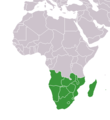
English: Countries of southern Africa.
Français : Les pays d'Afrique australe.
العربية: دول أفريقيا الجنوبية
datum
žórło File:BlankMap-World.png (originally uploaded to w:File:BlankMap-World.png)
awtor User:Vardion

Licencowanje

Public domain Dieses Werk wurde von seinem Urheber Vardion als gemeinfrei veröffentlicht. Dies gilt weltweit.

W někotrych krajach je to snano prawnisce njemóžno; jeli tomu tak je:
Vardion gewährt jedem das bedingungslose Recht, dieses Werk für jedweden Zweck zu nutzen, es sei denn, Bedingungen sind gesetzlich erforderlich.

Originalny protokol nahraćow

Die ursprüngliche Dateibeschreibungsseite war hier. Alle folgenden Benutzernamen beziehen sich auf en.wikipedia.
  • 2004-12-24 13:04 Lucidity 360×392× (13808 bytes) map of countries in Southern Africa
Die ursprüngliche Dateibeschreibungsseite war hier. Alle folgenden Benutzernamen beziehen sich auf en.wikipedia.
  • 2004-03-27 23:40 Joy ? (? bytes) map for [[Southern Africa]]

Krótkowopisy

Dodaj jednolinkowy wopis tuteje dataje.

W tutej dataji zwobraznjene objekty

motiw

MIME-Typ němčina

image/png

Prüfsumme němčina

2c572d269596e8c75d0c288f5bd830abd580d15e

Bestimmungsmethode němčina: SHA-1 němčina

Dateigröße němčina

10.099 Byte

392 Pixel

360 Pixel

Wersije dataje

Klikń na wěsty čas, zo by wersiju dataje w tutym času zwobraznił.

ČasWobrazowy napohladRozeznaćeWužiwarKomentar
aktualnje17. měrca 2018, 21:02Wobrazowy napohlad za wersiju wot 17. měrca 2018, 21:02360x392 (10 kB)MaphobbyistMontenegro border
9. julija 2011, 22:01Wobrazowy napohlad za wersiju wot 9. julija 2011, 22:01360x392 (13 kB)MaphobbyistSouth Sudan has become independent on July 9, 2011. Sudan and South Sudan are shown with the new international border between them.
5. meje 2006, 13:13Wobrazowy napohlad za wersiju wot 5. meje 2006, 13:13360x392 (4 kB)Hautalaoptimized with png
28. decembra 2004, 19:11Wobrazowy napohlad za wersiju wot 28. decembra 2004, 19:11360x392 (13 kB)Maximaximaxcountries of southern Africa (from en:) {{GFDL}}

Njejsu strony, kotrež tutu dataju wužiwaja.

Globalne wužiwanje dataje

Slědowace druhe wikije wužiwaja tutón wobraz:

Metadaty

Z Wikipedije, swobodneje encyklopedije