
Dataja:Relief Map of Germany.svg

Wersija z wyšim rozeznaćom (SVG-dataja, zakładna wulkosć: 1.073 × 1.272 pikselow, datajowa wulkosć: 6,54 MB)
Zjeće
| wopis |
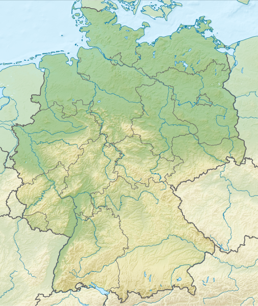
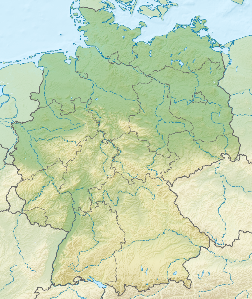
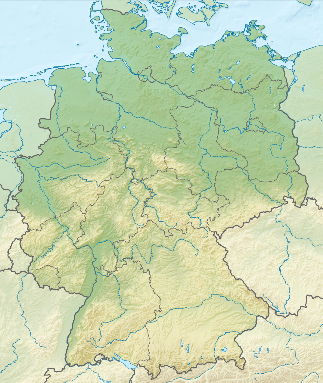
Deutsch: Positionskarte von Deutschland mit Gewässern
Quadratische Plattkarte, N-S-Streckung 150 %. Geographische Begrenzung der Karte:
English: Location map of Germany with waterbodies
Equirectangular projection, N/S stretching 150 %. Geographic limits of the map:
|
| datum | |
| žórło |
Swójske dźěło Diese Datei enthält Elemente, die von folgender Datei entnommen oder adaptiert wurden: Diese Datei enthält Elemente, die von folgender Datei entnommen oder adaptiert wurden: |
| awtor |
TUBS |
| druhe wersije tuteje dataje |
Bundesrepublik Deutschland (vor 1990 nur West-Deutschland):
Deutsche Demokratische Republik (mit BRD im Ausschnitt):
Ostdeutschland (vor 1990 Deutsche Demokratische Republik):
Deutschland zwischen Mai 1945 und Oktober 1949:
Thematisch:
Deutsches Reich (1918–1945) (best used with this template (de)):
|
| SVG‑Erstellung | Tuta wjeliki wektorska grafika je so z Adobe Illustrator zdźěłała. Diese grosse SVG-Datei wurde mit Commonist hochgeladen |


_23_May_1949_-_6_Oct_1949.svg)


_location_map.svg)
_location_map_2013.svg)


Licencowanje
- Směš:
- zhromadnje wužiwać – dźěło kopěrować, rozšěrić a dale dać
- změšeć – zo by dźěło přiměrił
- Pod slědowacymi wuměnjenjemi:
- připokazanje – Dyrbiš informacije wo awtorstwje podać, wotkaz k icency přidać a podać, kotre změny sće přewjedł. Móžeće to na přihódne wašnje činić, ale nic tak, zo zaćišć nastawa, zo licencudawar was abo waše wužiwanje podpěruje.
- dźělić – Jeli tute dźěło měnješ, přetworjuješ abo na njo natwarješ, móžeš hotowe dźěło jenož pod samsnej abo podobnej licencu kaž tuta rozšěrić.

|
Wenn du die Datei außerhalb der Wikipedia oder Commons verwendest, begrüße ich es, wenn du als Quelle Wikimedia Commons angeben könntest. Wenn du die Datei in einem Buch, Zeitung, Blog, Webseite, etc. verwendest, füge bitte hier folgende Zeile ein:
|
Wersije dataje
Klikń na wěsty čas, zo by wersiju dataje w tutym času zwobraznił.
| Čas | Wobrazowy napohlad | Rozeznaće | Wužiwar | Komentar | |
|---|---|---|---|---|---|
| aktualnje | 1. decembra 2011, 16:00 | | 1.073x1.272 (6,54 MB) | TUBS |
Datajowe wužiwanje
Dataja so na slědowacych stronach wužiwa:
- Bodamski jězor
- Dreetzsee
- Předłoha:LocMap/ramik
- Předłoha:LocMap/ramik/Dokumentacija
- Předłoha:LocMap Němska
- Předłoha:LocMap Němska/Dokumentacija
- Předłoha:LocMap Němska Badensko-Württembergska
- Předłoha:LocMap Němska Bayerska
- Předłoha:LocMap Němska Berlin
- Předłoha:LocMap Němska Braniborska
- Předłoha:LocMap Němska Bremen
- Předłoha:LocMap Němska Bremen (město)
- Předłoha:LocMap Němska Delnja Sakska
- Předłoha:LocMap Němska Durinska
- Předłoha:LocMap Němska Hamburg
- Předłoha:LocMap Němska Hessenska
- Předłoha:LocMap Němska Mecklenburgsko-Předpomorska
- Předłoha:LocMap Němska Porynsko-Pfalca
- Předłoha:LocMap Němska Posaarska
- Předłoha:LocMap Němska Sakska
- Předłoha:LocMap Němska Saksko-Anhaltska
- Předłoha:LocMap Němska Schleswigsko-Holsteinska
- Předłoha:LocMap Němska Sewjerorynsko-Westfalska
Globalne wužiwanje dataje
Slědowace druhe wikije wužiwaja tutón wobraz:
- Wužiwanje na an.wikipedia.org
- Wužiwanje na ar.wikipedia.org
- Wužiwanje na ast.wikipedia.org
- Wužiwanje na az.wikipedia.org
- Wužiwanje na ban.wikipedia.org
- Taman Nasional Swiss Saxon
- Taman Nasional Hunsrück-Hochwald
- Taman Nasional Eifel
- Taman Nasional Hainich
- Taman Nasional Kellerwald-Edersee
- Taman Nasional Harz
- Taman Nasional Lebah Oder Sor
- Taman Nasional Müritz
- Taman Nasional Wawengkon Laguna Pomerania Kawan
- Taman Nasional Jasmund
- Taman Nasional Segara Wadden Saxon Sor
- Danu Laacher
- Wužiwanje na ba.wikipedia.org
- Wužiwanje na be.wikipedia.org
Globalne wužiwanje tuteje dataje pokazać